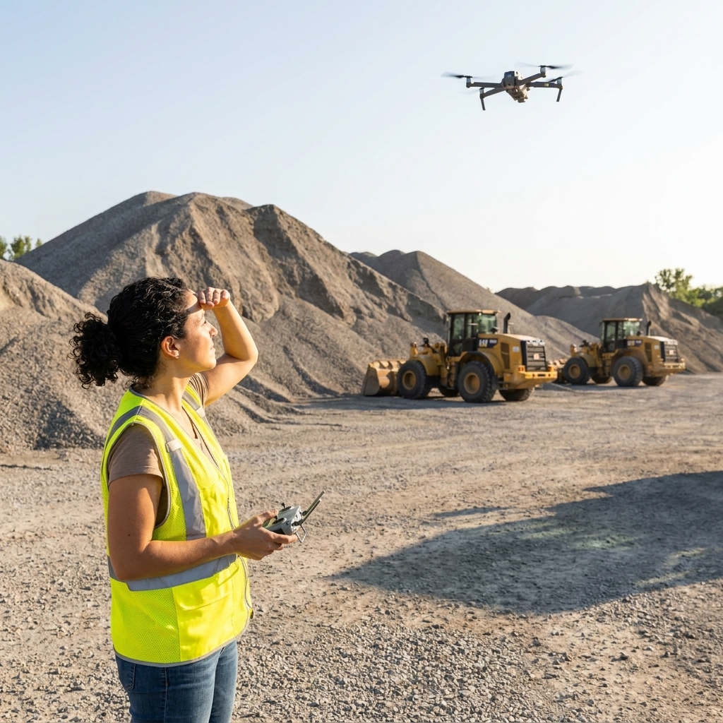
Drone mapping is one of those rare technologies that can pay you twice: once in the field through better decisions, and again in the back office through cleaner documentation. In commercial construction, that often looks like tighter earthwork quantities, fewer survey bottlenecks, and faster support for pay apps (payment applications, also called progress billing). In agriculture, it can show up as earlier problem detection, smarter variable-rate decisions, and better season-to-season records.
The catch is that drones do not create value by flying. They create value when your team can reliably turn imagery into measurements, maps, and actions. This guide walks you through implementing drone mapping software in a way that works operationally and makes financial sense.
What drone mapping software does
Drone mapping software is the bridge between flights and decisions. It typically handles four jobs:
- Flight planning: building repeatable routes, setting overlap, altitude, and camera angle so data is consistent.
- Processing: converting photos into georeferenced outputs like orthomosaics, point clouds, digital surface models (DSM), and digital terrain models (DTM).
- Measurement and analysis: volumes, cut and fill, stockpiles, plant health indices, drainage patterns, stand counts, and change detection.
- Sharing and audit trail: links, permissions, annotations, and exports to CAD, GIS, farm management tools, or project management systems.
Quick definitions: An orthomosaic is a stitched, scale-corrected map made from many photos. A DSM includes everything on the surface (piles, vegetation, equipment). A DTM aims to represent the bare earth, which matters for drainage and earthwork.
If you are evaluating tools, focus less on flashy renders and more on whether the platform produces consistent outputs your team will trust when money is on the line.
Use cases that move ROI
Commercial construction
- Earthwork quantities: frequent topo and volume reports can reduce disputes and help you catch grade drift earlier.
- Progress tracking: visual documentation can support pay apps, owner updates, and subcontractor coordination.
- Stockpile management: faster inventory counts can reduce rush orders and idle crews.
- As-builts and QA: compare design surfaces to reality and flag out-of-tolerance areas sooner.
- Safety planning: remote site capture can limit foot traffic in hazardous zones.
Agriculture
- Early detection: identify irrigation issues, nutrient deficiencies, pest pressure, and storm damage earlier than ground scouting alone.
- Variable-rate applications: map zones to guide fertilizer, seed, or chemical prescriptions when integrated with your agronomy workflow.
- Drainage and water management: terrain models help locate low spots, washouts, and flow paths.
- Stand counts and replant decisions: quantify emergence issues while there is still time to act.
- Documentation: season-long records support landlord reporting, crop insurance conversations, and operational learning.
My rule of thumb: pick one high-frequency use case to start. “We will map everything” is how programs stall. “We will deliver weekly stockpile volumes” or “We will scout 2,000 acres every 10 days” is how programs stick.
Step 1: Outcome and baseline
Before you buy anything, write down the decision you want the maps to improve and how you measure success. Two examples:
- Construction baseline: current survey cadence, average time to get a topo, number of quantity disputes per quarter, and rework hours tied to grade errors.
- Agriculture baseline: scouting labor hours, yield variability, number of acres treated “just in case,” and how often issues are found too late.
Then set a target that is operationally meaningful and financially measurable, such as:
- Reduce external survey spend by 30% on a specific set of sites.
- Cut time-to-quantity report from 7 days to 24 hours.
- Reduce blanket applications by 10% on a defined crop, field, or zone.
This is not busywork. It becomes your ROI model, your training plan, and your internal pitch when budgets get tight.
Step 2: Pick the right stack
Drone and sensors
Most teams do well with a practical, commercial mapping drone and one primary sensor to start:
- RGB camera: great for orthomosaics, progress photos, stockpiles, drainage observation, and general scouting.
- Multispectral: valuable in agriculture for vegetation indices, vigor mapping, and zone creation. Less common in construction unless you have niche applications.
- Thermal: useful for irrigation checks, solar inspection, and building envelope work. Typically a later addition.
- LiDAR: powerful for penetrating vegetation, complex terrain, and capturing surfaces where photogrammetry struggles. It can produce very accurate results, but it is not automatically “engineering grade.” Accuracy still depends on calibration, control, and a disciplined workflow.
RTK, PPK, and control
Accuracy is where many programs either win trust or lose it. In plain language:
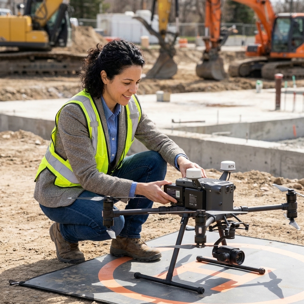
- RTK/PPK: improves the drone’s GNSS positioning by applying correction data, which reduces location error at the time of capture (RTK) or after the flight (PPK).
- Ground control points (GCPs) and checkpoints: known reference points measured on the ground that help constrain the model and validate results.
Just keep in mind that positioning is only one part of accuracy. Lens calibration, flight altitude, image overlap, surface texture, GCP layout, and processing settings all matter.
Relative vs absolute accuracy
Two different goals get mixed up all the time:
- Relative accuracy: repeatability from flight to flight for change detection (great for progress and trend tracking).
- Absolute accuracy: being tied correctly to real-world coordinates and elevations (critical for cut and fill, design comparisons, and defensible quantities).
If you need absolute accuracy, treat it as a specification. Decide up front whether you will rely on RTK/PPK only, GCPs, or RTK plus a small set of well-placed control and checkpoints.
Software fit
When you assess drone mapping platforms, test these “boring but profitable” features:
- Repeatable missions: the ability to fly the same route every week for clean change detection.
- Processing reliability: stable outputs and clear error handling, especially with large datasets.
- Export formats: CAD and GIS outputs for construction, and compatible layers for agronomy and equipment platforms for agriculture.
- Permissions and audit trail: who can view, edit, and approve deliverables.
- Cloud vs on-prem: cloud is usually faster to deploy, on-prem can matter if you have strict data policies or low connectivity.

Step 3: Capture good data
If the capture is inconsistent, the deliverables will be inconsistent. A few practical rules keep you out of trouble.
Overlap and GSD basics
- Overlap: many mapping missions work well around 75 to 85% front overlap and 65 to 75% side overlap for RGB photogrammetry. If you are seeing holes, noisy surfaces, or poor edges, increase overlap.
- GSD (ground sampling distance): this is the size of one pixel on the ground. Lower GSD (flying lower) generally increases detail but increases flight time and processing load. Pick a standard for each deliverable type so results are comparable.
When not to fly
- Wind and gusts: can blur images and reduce model quality.
- Low light: creates motion blur and inconsistent exposure.
- Dust, heavy haze, or smoke: reduces clarity and can confuse processing.
- Reflective or uniform surfaces: standing water, shiny roofs, and featureless snow or sand can reduce tie points and create artifacts.
Step 4: Build a workflow
Most drone programs fail because only one person knows how to do everything. Your goal is a simple assembly line: plan, fly, upload, process, review, distribute.
Construction workflow (weekly)
- Monday: schedule flight window around site activity and safety plan.
- Tuesday: fly mission and upload data the same day.
- Wednesday: process deliverables, generate volume and topo reports.
- Thursday: superintendent and PM review, annotate issues, share with subs or owner.
- Friday: archive outputs and log lessons learned.
Agriculture workflow (10 to 14 days)
- Plan: prioritize fields by crop stage, known risk areas, and irrigation zones.
- Fly: capture consistent overlap and time of day where possible.
- Process: generate orthomosaic and vegetation layers if applicable.
- Interpret: agronomist or farm manager flags zones and assigns ground checks.
- Act: decide on targeted treatment, irrigation adjustments, or replant.
- Document: store outputs with date and field ID for season-long learning.
Write this as a one-page SOP. The best SOPs fit on a clipboard and survive real life.
Step 5: Compliance and risk
Drone programs get delayed when compliance is treated as an afterthought. Keep it simple and systematic.
Commercial operations (US)
- Pilot requirements: confirm your pilots hold the appropriate certification for commercial operations (often FAA Part 107).
- Airspace checks: verify if authorization is needed and document approvals (LAANC is common, and some locations require waivers or additional steps).
- Insurance: carry appropriate liability coverage and confirm whether your policy covers subcontracted pilots.
- Site safety: define takeoff and landing zones, communication with crews, and no-fly triggers (wind, dust, active lifts).
- Data governance: who owns the data, retention periods, and how client data is shared.
Rules and tools change. Make it a habit to check current FAA guidance and your local requirements before you standardize a policy.
For agriculture, privacy and neighbor relations also matter. A simple practice is to map only your fields and maintain a “do not record” buffer where practical.
Step 6: Pilot in 30 to 60 days
Think of your first phase like a financial proof-of-concept. You are not trying to perfect everything. You are trying to prove repeatability and value.
Pick one site or unit
- Construction: choose a site with meaningful earthwork and a PM who will actually use the outputs.
- Agriculture: choose a set of fields where you can tie insights to actions, not just pretty maps.
Define deliverables
Examples:
- Weekly orthomosaic plus stockpile volumes with a standardized report template.
- Biweekly orthomosaic plus vigor layer and a “zones to scout” checklist.
Track three numbers
- Time saved: survey days avoided, scouting hours reduced, fewer drive-arounds.
- Cost avoided: rework, wasted inputs, rush material orders, external survey invoices.
- Revenue protected or accelerated: earlier billing support, reduced downtime, yield protection from earlier intervention.
Mini examples (use as templates)
- Construction: weekly stockpile reports replaced one third-party inventory visit per month and cut turnaround from several days to next-day reporting. The measurable win was fewer surprise material shortages and less time spent reconciling quantities.
- Agriculture: a 10 to 14 day scouting cadence flagged irrigation uniformity issues early enough to trigger targeted ground checks and adjustments. The measurable win was fewer unnecessary passes and better documentation for season review.
Use your pilot to generate your own numbers. Those are the benchmarks leadership will trust most.
Step 7: ROI you can defend
When you pitch drone mapping internally, avoid vague statements like “better visibility.” Tie benefits to cash flow, risk reduction, and labor capacity.
Costs to include
- Hardware: drone, batteries, spare props, tablet, hard case, charging setup.
- Sensors: multispectral, thermal, or LiDAR if applicable.
- Software: mapping subscription, processing credits, and any integrations.
- Training: pilot time, certification, and internal onboarding.
- Labor: flight time, processing time, report creation, and review time.
- Insurance and compliance: coverage, authorizations, and policy work.
Benefits that quantify well
- Survey cost offset: fewer third-party topographic updates or faster internal refreshes.
- Rework reduction: catching grade errors, drainage issues, or stand problems earlier.
- Input efficiency: fewer acres treated unnecessarily, better timing of applications.
- Schedule compression: faster decisions that keep crews moving or reduce field passes.
- Claims and documentation: stronger evidence for change orders, delays, storm damage, and insurance discussions.
Accuracy expectations (practical callout)
Accuracy varies widely based on workflow, terrain, and execution. A useful way to frame it:
- RTK or PPK only: can be very good for repeatable progress tracking and many quantity workflows, but do not assume it is always enough for engineering-grade comparisons.
- RTK or PPK plus GCPs and checkpoints: typically increases confidence for cut and fill, design comparisons, and defensible reporting because you are both constraining and validating the model.
If dollars depend on a number, document your method every time and validate it against known points on the ground.
Simple ROI framework
Build a one-page table for leadership:
- Annual program cost (all-in)
- Annual savings (conservative estimate)
- Annual value protection (risk reduction, documented)
- Payback period = cost divided by monthly net benefit
If your payback is under 12 months on a pilot, scaling becomes a business decision, not a tech hobby.
Step 8: Integrations
Drone mapping tends to deliver the most value when it lands in the tools your team lives in daily.
Construction integrations
- CAD and BIM: surfaces and point clouds for engineering teams.
- Project management: progress deliverables linked to RFIs, submittals, and pay apps.
- GIS: asset tracking for utilities, roads, and long linear projects.
Agriculture integrations
- Farm management records: field IDs, crop history, and notes linked to dates.
- Agronomy workflow: zones for scouting and prescriptions where applicable.
- Equipment compatibility: ensuring outputs can be used by the machinery and service providers you rely on.
One caution I learned watching my parents run their business: data that lives “somewhere else” becomes a tax. If maps are hard to find or hard to share, they quietly stop being used.
Step 9: Storage and versioning
Teams underestimate storage until they get their first big season or multi-month project. Decide this early, then make it boring and consistent.
What to keep
- Raw imagery: keep it long enough to reprocess when specs change, a dispute shows up, or you need to validate results later.
- Processed outputs: keep the final orthomosaic, surfaces, reports, and exports that were actually delivered.
- Processing reports and settings: these are part of your audit trail and help you reproduce results.
Naming and retention
- Naming: standardize a simple convention like Project or Field + Date + Deliverable + Version.
- Retention: align with contract terms, internal policy, and any regulatory requirements. When in doubt, keep raw data longer for construction projects where claims and changes can surface late.
Step 10: Scale with QC
Define roles
- Pilot operator: owns flight safety and data capture.
- Processing lead: owns processing settings, templates, and output consistency.
- Reviewer: validates measurements and signs off on deliverables.
- Stakeholder owner: PM, superintendent, or farm manager who turns insights into action.
Quality checklist
- Correct project or field name and date
- Flight altitude, overlap, and GSD within standard
- RTK/PPK or GCP method documented
- Processing report saved
- Measurement method consistent week to week
- Export format correct for the recipient
Standardize templates
Templates are not bureaucracy. They are how you make results comparable over time. For construction, that might be a weekly volume report with the same cut and fill bins. For agriculture, it might be a consistent set of layers and a short “what changed since last flight” note.
Pitfalls to avoid
- Buying LiDAR before you need it: start with RGB unless your use case truly demands more.
- No plan for accuracy: if you need defensible numbers, design the control and validation workflow from day one.
- Processing bottlenecks: large datasets can overwhelm laptops and people. Budget for cloud processing or a capable workstation.
- Outputs no one uses: deliver fewer, more decision-ready products, not a folder of files.
- Underestimating training: the value is in consistent execution, not one-time enthusiasm.
FAQ
How accurate is drone mapping for construction quantities?
Accuracy depends on your positioning workflow (RTK or PPK, GCPs, checkpoints), flight parameters, surface conditions, and processing settings. For earthwork and stockpiles where dollars are attached, treat accuracy as a specification, not a hope. Document your method every time so measurements are defensible.
Do I need to hire a surveyor?
For legal boundary work and certain engineering requirements, yes, a licensed surveyor is often necessary. Many teams use drones to supplement survey work by increasing frequency and reducing turnaround time, then rely on licensed professionals for stamped deliverables where required.
Is drone mapping worth it for mid-sized farms?
It can be, especially if you have high-value crops, irrigation complexity, or acreage where scouting is time-consuming. The best returns tend to come from using maps to trigger targeted ground checks and more precise input decisions.
Should we outsource flights or build in-house?
Outsourcing can be smart if you need occasional mapping or want to validate a business case quickly. In-house usually wins when you need frequent flights and fast turnaround. Many organizations start outsourced, then bring it in-house once cadence and value are proven.
A practical next step
If you want momentum without overcommitting, do this: pick one site or one farm unit, define a single deliverable, and run a 30-day pilot with a weekly or biweekly cadence. Track time saved, costs avoided, and one clear “decision improved” story. That combination earns budget approval and turns drone mapping into a real operating capability, not a gadget.